<< Home … Weather … Geology … Space >>
Maps
Instructions – Maps Cover Page.
It’s easy to take maps for granted. Most smartphone users have tried Google Maps at least once or twice. Scan this list of six other maps available from your phone’s browser. Have you ever used one of these?
Just for kicks, scan Wikipedia articles about MapQuest and Google Maps. These are the two most prominent online maps available to consumers at the moment.
You’ll notice that MapQuest’s origins date to 1967. This was long before the world wide web (www) started in 1991. MapQuest was not called MapQuest back then. Rather, it started as Cartographic Services, a division of R.R. Donnelley & Sons. Today, MapQuest is owned by Verizon.
Paper maps became important especially after Henry Ford began mass-producing cars in 1920. Drivers needed DRIVING DIRECTIONS, of course. Then in the mid-1950’s the Interstate Highway System was put into motion. Combined – lots and lots of cars – lots and lots of drivers – meant lots and lots of maps!
Side note: Browse this Wikipedia article about the start of the internet … evolving into the world-wide-web. I bet you didn’t know this!
Highly Abbreviated History of Smartphone Maps
- A long-long time ago maps were drawn on paper.
- 1913 – Ford began mass producing cars.
- 1916 – The Federal Road Act was put in place.
- 1920 – Mass production became popularized (a lot of cars).
- 1956 – The Interstate Highway System was put into place.
- 1967 – Cartographic Services began (aka MapQuest).
- 1991 – The World Wide Web was launched (but, still unknown).
- 1996 – MapQuest was launched on Internet.
- 1998 – Google started.
- 2000 – AOL purchased MapQuest
- 2001 – Most US households now had internet access.
- 2005 – Google Maps started.
- 2016 – Verizon purchased MapQuest
- 2020 – You are awesome and know how to use these things!
So … this history is ONLY about maps that help you drive somewhere. You probably know that there are a bunch of other types of maps. You’ve seen weather maps, world maps, and a whole variety of different demographic maps – although you might not have realized it.
Computers have significantly changed the way maps are created, produced, and used. Earth scientists depend heavily on a wide variety of maps. Three important types of earth science maps include:
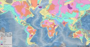
Map image is public domain by USGS and Wikipedia Commons.
Summary
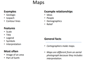
Broadly, map analysis is a study is made regarding map types (which could include geologic maps, isopach maps, contour lines etc.), and the unique physical qualities of a map such as scale, title, and legend. It is also a ways of decoding the message and symbols of map and placing it within its proper context. A map is an image of an area, usually of the Earth or part of the Earth. A map is different from an aerial photograph because it includes interpretation. The word “map” can also be used to talk about a chart or drawing that shows relationships between ideas, people, events, or anything else you can think about. People who make maps are cartographers.
Student Handout Material
- Instructions – Maps Cover Page
- Work Packet – Maps Part 1
- Work Packet – Maps Part 2
- Work Packet – Maps Part 3 (Hands-on)
Survey Monkey
Question? Ask me a question. You can mark it as private or public. I will try to answer the public questions before the next class. Thanks!
Videos (Part 1)
3:51 Lesson 3 – Part 1: Introduction to Cartography
1:55 How to Read a Weather Map
3:05 How to orient a map and take a bearing with a compass. The basics of how to use a compass and map.
Wednesday (Hands-On 2)
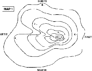
This hands-on activity introduces concepts, applications, and usage of topographic maps. Materials needed: poster board, scissors, glue or glue sticks, pencil or pen. You were provided printed sheets for this activity. But, if it was lost, you can reprint the Work Packet.
Diagram adapted from Berkeley.edu
Videos for Hands-On Activities
1:41 What Is Topography?
3:47 How to Read a Topo Map
3:59 How to Draw Contour Lines on a Map
SENIORS … Consider Doing This … Compare Contrast and Debate
Write an Opinion Paper:
Map making dates back thousands of years. With each new century, improvements have taken place in both the art and the science of maps. Today, most people have reasonably easy access to GPS-type of maps, at the touch of a smart phone or computer. Some might argue that paper-based maps and other non-digital maps are truly a think of the past and are entirely obsolete. Others might argue that significant value still exists in non-digital maps – and there will be an ongoing need, in spite of advancements of computer technology – to maintain both the art and science of traditional map making.
- Position A: Paper-based maps are obsolete. Education systems should focus exclusively on digital/computerized maps
- Position B: Both computer-based maps and paper-based maps are important map-types for students and others to use and understand.
Complete the Week
- Get a clean sheet of paper. Down the left-hand side write numbers one through twenty (1-20).
- Alongside each number, you will write an answer choice A, B, C, or D.
- The week’s final quiz requires two parts (view a pdf – enter your responses).
- View the maps and associated questions. Record your answers on your sheet of paper.
- Launch the Survey Monkey form. Select A, B, C, or D per your hand-written responses.
- Your score will be displayed automatically along with the correct responses.
- Review the pdf for understanding of items you missed.
- PLEASE DO NOT SHARE ANSWERS WITH OTHER STUDENTS.
- Map A
- Map B
- Map C
- Map D
- Map E
- Enter Your Answers – Survey Monkey online response form.
- All Maps (not recommended – very large file)
Standards and Emphasis
Science and Engineering Practices
- Obtain, evaluate, and communicate information
Cross-Cutting Emphasis
- Develop and use models
- Scale, Proportion, & Quantity
- Systems & System Models
About us ……… Terms of use


